3Map

Information Management System for Geolocalized Data

Data for Local Decision-Making

Collect, Analyse and Share Geolocalized Data

3Map is a single platform for collecting, recording, visualising, analysing and sharing different types of data capable of involving non-technical users in understanding and using data to make decisions at the local scale.

Flexible
3Map allows to define any data structure so it can adapt to many fields that require the study of geolocalised data
User-friendly
Data collection with 3Map is simple, fast, intuitive and available even without an internet connection
Insightful
Uncover the dynamic evolution of your geolocated data over time, helping you find valuable patterns and insights for smarter decision-making
Interoperable
Seamlessly integrate with external systems. Link diverse data sources, create customized data dashboards, and deliver real-time updates through messaging platforms like Telegram and WhatsApp

Define the data structure

3Map Admin

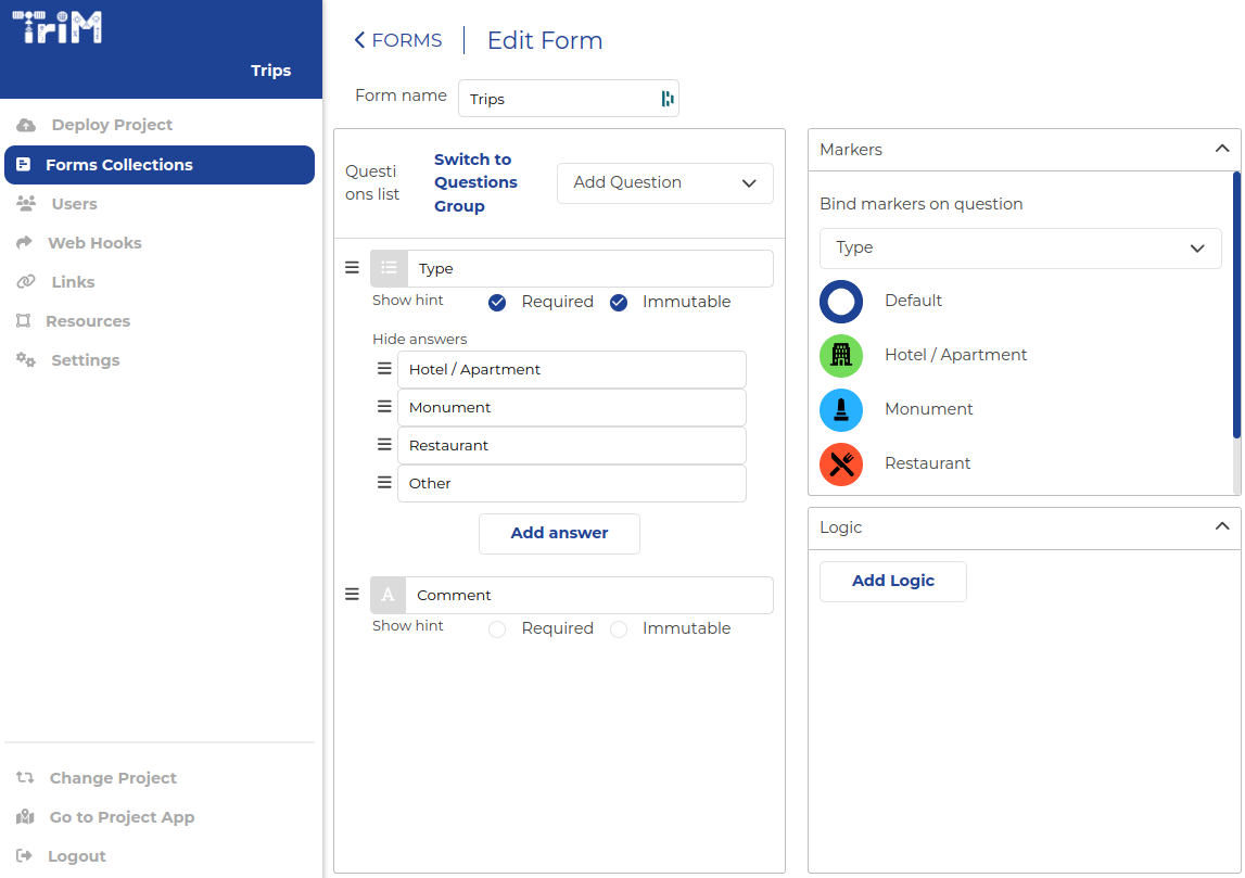
3Map-admin is a web app for creating data collection forms. Users can define data structures, create forms, and manage projects. Project creators become Admins with exclusive access to project settings.

Features:

  • Create projects and associated forms.
  • Admins invite users, build forms, and assign users to forms.
  • Administration section is in English but adaptable to other languages.
  • Forms can use preferred languages.

3Map-admin streamlines data collection and management for user-specific projects.

3mapAdmin

Collect data in the field

3Map Mobile

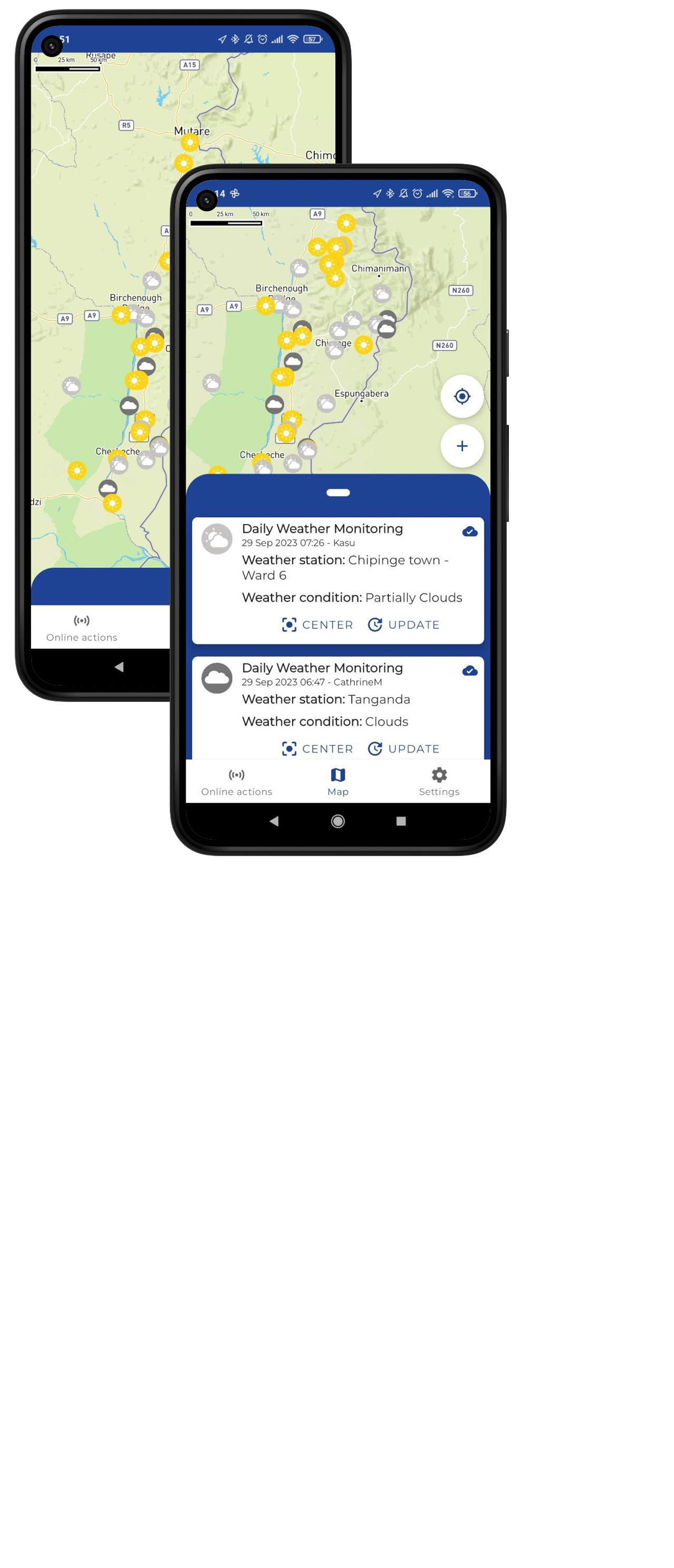
3Map-mobile is a user-friendly app for smartphones and tablets. It allows project members to collect data, including text, numbers, and images, with automatic GPS tagging. Users can access and update data in real-time, making it easy to track and relate various variables over time, such as water resources or crop production.

The app is designed to be intuitive and accessible for all users, even those with limited literacy, and offers interactive map visualization for complex contexts.

3mapMobile

Comprehensive Data Management

3Map Project

3Map-project is a web application for comprehensive data management. It simplifies database tasks, including access, viewing, modification, updating, analysis, and sharing.

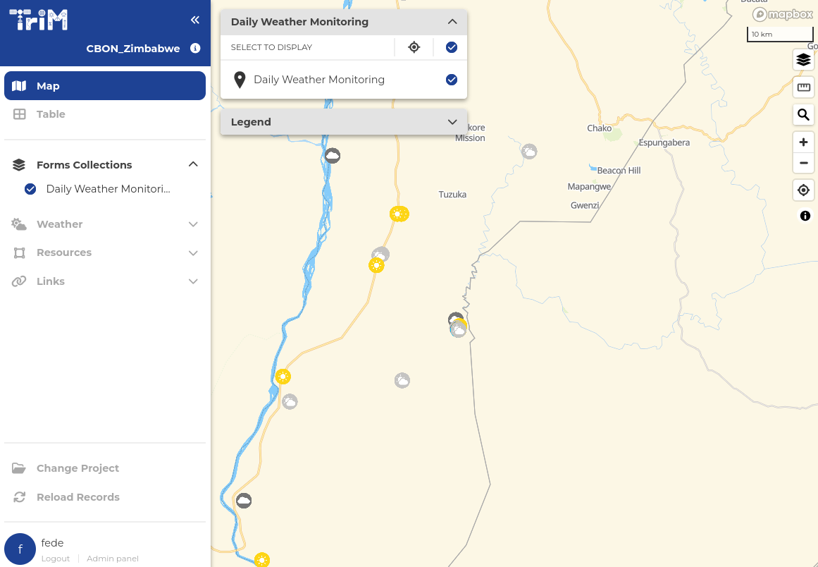
The app displays geolocated data as map markers and tables. Users can apply specific filters for targeted analysis by time periods or geographic areas.

Through the 3Map platform, it integrates data with vital information like satellite imagery and climate models, useful for understanding environmental cause-and-effect in environmental and agricultural projects.

3mapProject

Real-time data dissemination

AI-powered chat reports

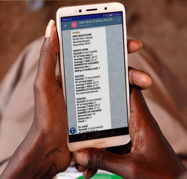
3Map facilitates the creation of informative reports and bulletins based on the collected data.

Certain projects may collect a substantial amount of qualitative text data that is difficult to consolidate and summarize.

3Map uses AI to eliminate redundancy and duplication in the data while preserving vital information. These reports can be generated instantly or scheduled periodically (monthly, weekly, etc.), presenting aggregated and summarized data for the designated timeframe and delivered via instant messaging applications.

3mapProject

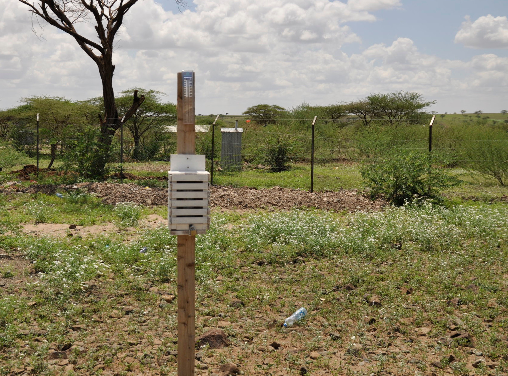
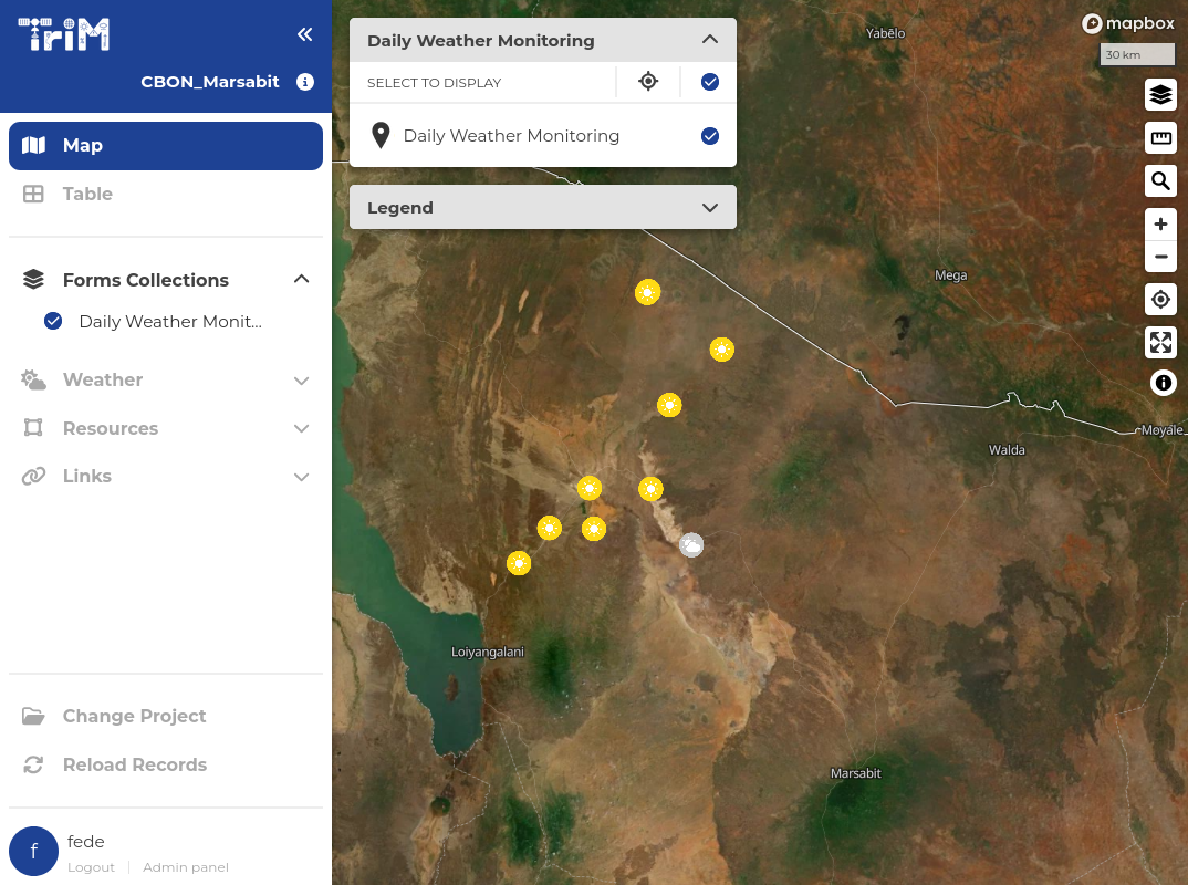
Community Based Observation Network

Empowering East African Communities to Address Climate Challenges Enhancing Flood and Drought Preparedness through Data.

App screenshot

Meteorological data

3Map Weather

Overlay weather models and satellite information and understand how weather conditions impact your data.

App screenshot
Weather Forecast
Up-to-date forecasts from both global-scale and high resolution local models
Historical Rainfall
Global satellite rainfall data from 2000 to present, with daily to yearly accumulation
Vegetation Index
Assess vegetation health and land cover changes
Charts view
Analyze trends and explore weather data for specific locations through charts
Countries
6
Active Projects
25+
Active Users
270+
Collected Records
85,000+

Start using 3Map

Discover how our platform can streamline your data collection process with powerful geolocalized insights.

Enter your email to schedule a live demonstration or receive more details!

We care about your data. Read our privacy policy.

App screenshot

Trusted by

CISPAMREFACTIONAIDTDHVSF-G